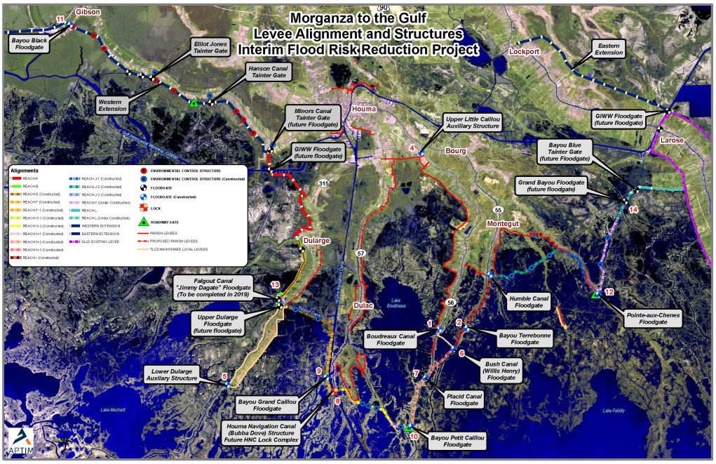
The Morganza-to-the-Gulf Hurricane Protection System is a levee, lock, and floodgate system designed to provide 100-year, Category 3 storm surge protection to more than 150,000 Americans living in coastal Terrebonne and Lafourche Parishes (60 miles southwest of New Orleans) as well as over 1,700 square miles of fresh and saltwater marsh.
2013 MORGANZA-TO-THE-GULF PROJECT FACT SHEET BASED ON USACE PAC REPORT
The recommended plan described in the U.S. Army Corps of Engineers January 2013 Post Authorization Change Report (PAC) consists of 98 miles of grass-covered earthen levees tying into US 90 near the town of Gibson to the west and Hwy 1 near Lockport, LA to the east. The southern boundary is the Gulf of Mexico.
The tentatively selected plan in the PAC report consists of:
- approximately 98-miles of earthen levees ranging from 9 – 15 feet
- 22 floodgates on navigable waterways
- 23 environmental water control structures
- 1 lock complex consisting of a lock in the Houma Navigation Canal measuring 110-ft wide by 800-ft long, an adjoining floodgate measuring 250 feet wide, and a dam closure
- 9 road gates
- fronting protection for four (4) existing pump stations.
No Federal funds have been appropriated for construction of the Morganza to the Gulf project; however, the non-Federal sponsor is using state and local funds to construct interim features along the authorized alignment in advance of the Federal project.
